Section 6: Special Route Markers
Anchor: #i1009104Evacuation Route Signing (EM-1 series)
The Division of Emergency Management and the Department of Public Safety, acting through local disaster district committees, have established hurricane evacuation routes for each of the five coastal districts. The HURRICANE EVACUATION ROUTE sign (EM-1aT) with a hurricane symbol should be used to mark these routes. See Standard Highway Sign Designs for Texas (SHSD) for sign details.
Evacuation route signs should be installed at critical intersections along evacuation routes and any other appropriate locations between intersections. The sign should be mounted under the route marker for evacuation routes on the existing support, if possible. If a sign is independently mounted as a confirmation route or with a directional arrow or a directional marker, it should be installed on an approved breakaway support.
See the Hurricane Information page of the TxDOT website for additional evacuation route information.
Anchor: #i1009124Texas Travel Trails (Texas Heritage Trails Program)
The Texas Travel Trails are a series of 10 pleasure-driving routes that were established in 1967 and became operational in 1968. The Trails were founded at the direction of Governor John Connally as a Texas tourism feature to identify and promote a series of motor-vehicle routes that follow trails that have historical, cultural, or geographical significance. The program is managed by the Texas Historical Commission (THC) and is referred to as the Texas Heritage Trails Program.
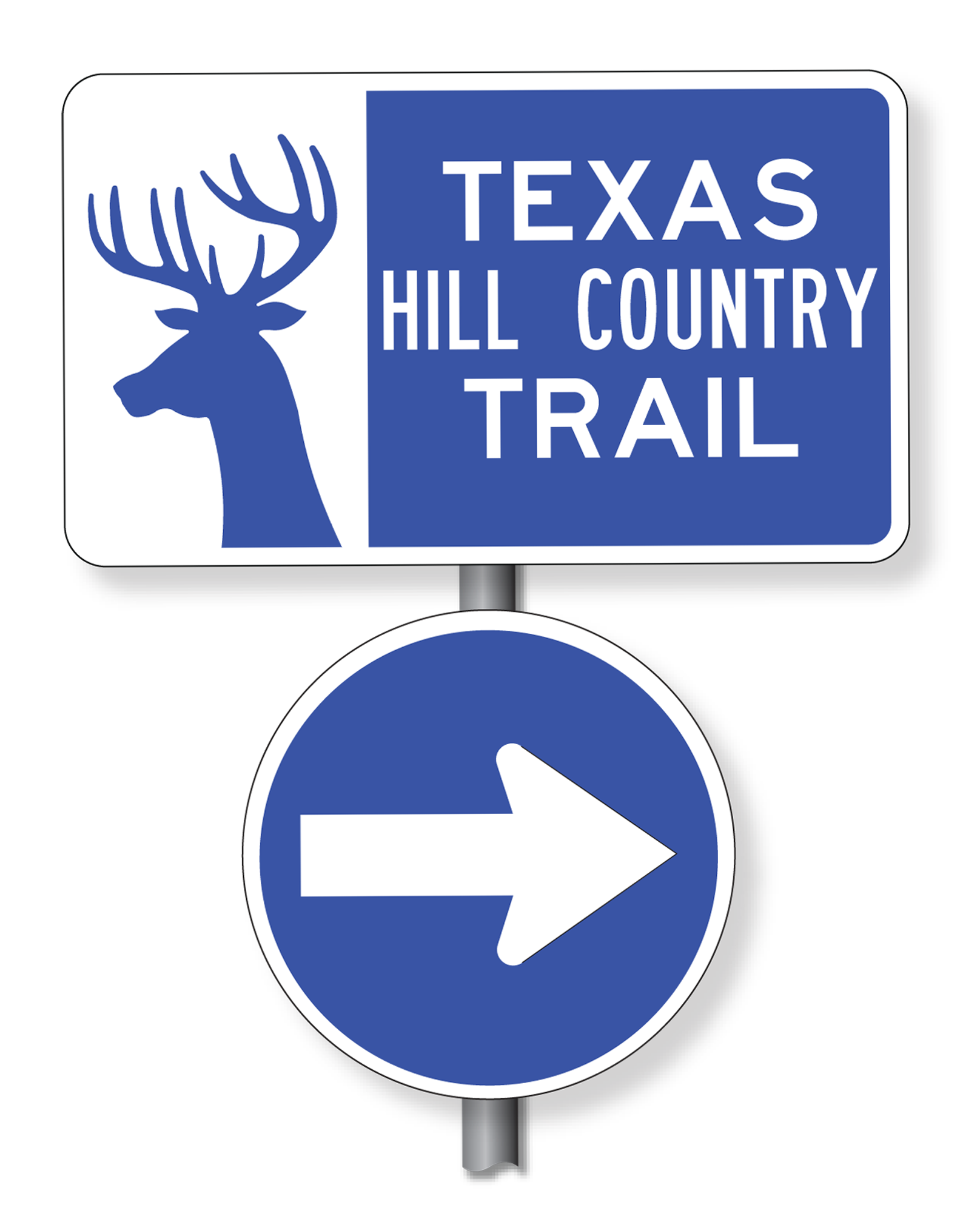
The Texas Department of Transportation (TxDOT) installs and maintains the Texas Heritage Trails signs (D71 series). The signs are 42 × 24 inches. The trail arrows are 18 inches and 24 inches in diameter. Signs and trail arrows are obtained from the Support Services Division’s regional distribution centers. Figure 7‑3 shows an example of a Texas Heritage Trail marker and associated directional arrow. See the SHSD for sign details.
Districts should maintain close observation of trail signing, and promptly obtain and install replacements as needed to assure that the route remains well marked for motorists who are following the trail. Any problems or confusion about a particular trail route segment should be brought to the attention of the THC.
Existing designated Texas Travel Trails are:
- Anchor: #SJEWTOEV
- TEXAS BRAZOS TRAIL (D71-BR) Anchor: #GPMKHOFE
- TEXAS FOREST TRAIL (D71-FR) Anchor: #FQCIMOIB
- TEXAS FORTS TRAIL (D71-FT) Anchor: #UQYADWVO
- TEXAS HILL COUNTRY TRAIL (D71-HC) Anchor: #INUOQONU
- TEXAS INDEPENDENCE TRAIL (D71-IN) Anchor: #YPYOOFNP
- TEXAS LAKES TRAIL (D71-LA) Anchor: #GFYJKMGK
- TEXAS MOUNTAIN TRAIL (D71-MT) Anchor: #ODTCNMMX
- TEXAS PECOS TRAIL (D71-PE) Anchor: #EEJRATIN
- TEXAS PLAINS TRAIL (D71-PL) Anchor: #FCDXNRVH
- TEXAS TROPICAL TRAIL (D71-TR).
Figure 7-3. Example of Texas Heritage Trail Marker (Trail arrow may be reversed for left turn.)
Anchor: #i1080193Texas Travel Trail Signing Standards
The following signing standards apply to Texas Travel Trail signs:
- Anchor: #TNGXQBCJ
- Trail arrows should not be mounted separately. They should always be mounted with the trail marker sign before an intersection. Anchor: #HUPGUHOU
- Trail signs should be mounted independently from other highway signs at intersections where the trail route leaves one numbered highway and joins another numbered highway. Trail signs may be used as necessary to provide trail route confirmation to motorists. Anchor: #IUIJKEYI
- A trail marker may be used to identify and confirm the route periodically. It may be mounted without a trail arrow, typically at 100 feet beyond the first confirmation marker leaving an intersection. It should be located so as not to interfere with distance signs. Anchor: #SXYNKLGT
- Along the same highway, a trail marker sign should be used to provide trail route confirmation for traffic leaving a city or town. It should be placed near a highway route marker. Trail markers may be used as necessary to provide trail route confirmation to motorists. Anchor: #SLJSGSRN
- On multi-lane highways, trail signs should be mounted independently from other highway signs near the exit direction assemblies.
